
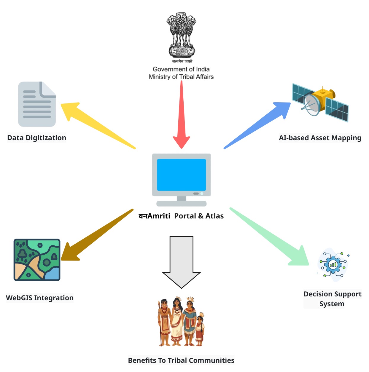
वनAmriti Portal & Atlas
FRA Atlas • WebGIS • Decision Support
FRA Atlas • WebGIS • Decision Support
वनAmriti is a simple, secure and standards-based platform to digitize FRA records, map village assets using satellite data, visualize everything on a WebGIS Atlas and help departments layer schemes through an explainable Decision Support System.
A unified portal to bring together legacy FRA claims, community/village boundaries, and asset layers (ponds, cropland, forests, homesteads) in one place. It supports districts with clean data, clear visuals, and transparent recommendations for scheme convergence.
OCR + field extraction to standardize IFR/CR/CFR data with audit trails.
Satellite-based layers of ponds, cropland, forest cover and built-up areas.
Filter by state/district/village, view FRA status and download summaries.
Simple rules highlight where to prioritize water assets or scheme linkages.
Public view shows only aggregated, PII‑free information. Named claimant data is visible only to authorized roles as per policy.
Clean lists for verification, easy maps for reviews, and simple recommendations to plan water/land works with communities.
Open the Atlas to explore FRA status and asset layers for your area.