Harnessing Technology for Forest Rights

Digital Record Keeping
To digitize all legacy FRA claims and records, using AI to extract and standardize data for a secure and accessible digital archive.

AI-Powered Asset Mapping
Using satellite imagery and AI to map forest resources, water bodies, and farms, creating a detailed and accurate FRA Atlas.

Interactive Web Portal
To develop an integrated WebGIS portal for visualizing spatial and socio-economic data, ensuring transparent tracking of FRA progress.
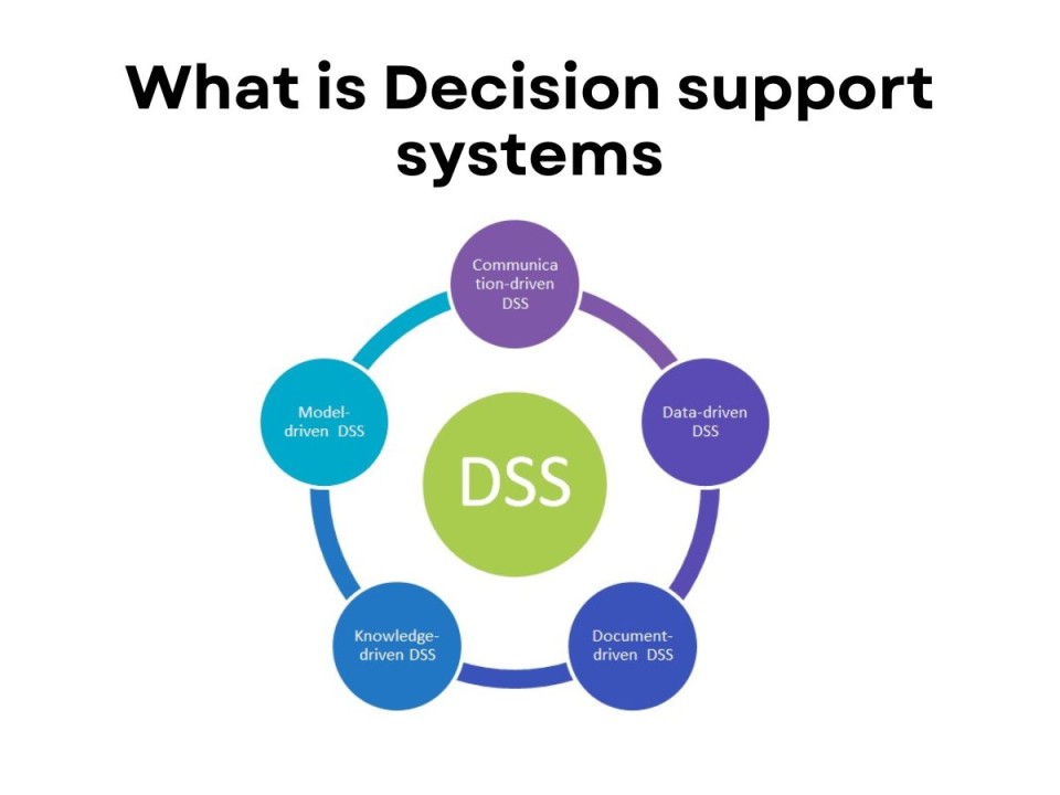
Smart Development Planning
A Decision Support System (DSS) to intelligently recommend government schemes, ensuring targeted development for FRA-holding villages.
0
Individual & Community Claims Filed
0
Land Titles Distributed
0
Hectares of Forest Land Secured
0
Villages Benefited